Why the fascination with the Northwest Passage in the northernmost territories of Canada, given that I had been inside the Arctic Circles and all the way to North Cape on my Harley in the summer of '16 and we went there on a cruise in the winter of '21. It can hardly have been for the scenery, as Jean observed - "It's barren and bleak, completely without trees! So why?". But, it has considerable history and an awesome bleakness that needed to be seen to be appreciated, however raw! I definitely get more of a buzz from bleakness and nothingness, first discovered on survey work in the desert of Oman in '78.
For 400 years, discovering this passage across the roof of the world was the holy grail for European explorers. Mapping it would lead to quicker trading routes with Asia, and all the riches that would follow. But this is treacherous territory, with 36,500 islands, extreme weather, giant icebergs and vast expanses of drifting sea ice that can trap ships for years. Many tried, and all except one failed, some disappearing without a trace. Most notably, Sir John Franklin's expedition of 1845 disappeared and lost 129 men. It was not until 1906 that it was first traversed, by Roald Amundsen, and it was 1969 before the first commercial ship passed through it. Franklin's two ships, HMS Erebus & Terror, were not found until '14 and '16 respectively and little remains known about their fate and suffering. It is not yet known exactly what happened and when or how each ship foundered.
It is a very hostile place, although a small window of a few weeks has existed for limited cruises since '07 when the ice has melted enough for it to be safe. It has been a compelling attraction to me for some years, so we booked to sail at the end of August with warnings about changes of itinerary, subject to the ice conditions. Perhaps it is one of the few 'benefits' of Global Warming!
We flew first to Montreal and then onward by charter flight to join our ship, MS Fram, in Cambridge Bay in the Province of Nunavut:
 |
| Cruise Route |
After delays from an ATC problem in UK the day before, we feared disruption but left and arrived 20 mins late. The journey wasn't to be without frustration, however, as we had barely cleared the ramp in Montreal before we hit a long queue for Immigration etc.
That was the queue we had yet to reach while waiting above! 2 hours later, we finally made it our hotel.
Next day started early with heavy rain and thunder, which fortunately didn't completely prevent our city tour, but did rather spoil views and an ability to stop.
Deluge at 6:30am!
 |
| Lunch in a multi-screen sports bar |
One street where all the upper floor properties have their own outside staircases
Olympic Stadium
 |
| Rain returns! |
Piece of the Berlin Wall
in a shopping mall
 |
| Infinity Pool |
St Joseph's Oratory, high on Mount Royal
Olympic Stadium from Mount Royal & Jean of course!
Overall, I thought Montreal had some lovely old buildings, some glass towers, but looks much better at street level than from the air, where the walls cannot be seen, the roofs being mostly flat and the grid layout looks rather bleak.
 |
Territory of Nunavut
and some of the key places
and waterways |
A mighty early start and a long day with a 7 hour flight from Montreal via a dogleg to Iqaluit (shown lower-right on Baffin Island above) to refuel before onward to Cambridge Bay finally got us to our start point, with the cruise ship anchored and ready.
We had a walk around this bleak and barren community of 1,700 people, visiting the School, Museum & Visitor Centre and guided by two young local people. Then, at last, it was time to board our ship, MS Fram, by Zodiac and get on the water of the NW Passage.
Airport musk ox welcome
Young local guides
Curling Rink
Nunavut, Canada, Community flags
School/Museum/Library
 |
| MS Fram & Zodiacs await us |
 |
| At last! |
Here we come!
Check-in was very welcome at the end of a long day!
Twilight arrives, no night
Off we sailed soon after boarding and check-in, heading for the channel where HMS Erebus and Terror wrecks were found, 170yrs after they went missing, round the south of King William Island and onward to Gjoa Haven.
 |
| The all important Lounge & Bar! |
Captain & Crew's welcome
Inuit oil lamp demo
There is a large Expedition Team on board, made up of diverse specialists and scientists, some 20 or so. There is scientific data gathering on board as the ship provides one of the few opportunities when the ice opens, and there are very strict conditions of travel and shore visiting to avoid damage to the environment.
We anchored near to Gjoa Haven, the small bay where Roald Amundsen wintered, frozen in, and learned about Inuit ways to stay warm with fur clothing, for example. This all enabled him to find the NW Passage in his small ship with just 6 people in the sometimes shallow waters of the area. Every other expedition used large vessels with huge stores for being frozen up for multiple winters and lots of crew. His success in the Arctic also helped him win the race to the South Pole in the Antarctic.
It's another small place of some 1,500 people with their large 4x4 V8 pickups, quad bikes and skidoos for the winter, after a Zodiac beach landing to walk around with a local guide.
We were regaled with Inuit songs that tell stories. They seemed very long and the shouting or grunting of the drummer at certain points was unexplained! Fellow cruisers were invited to drum, mostly without technique and humility, and the local people were gracious in their applause!
 |
| The crocodile back to the Zodiacs |
Next day, we cruised north, passing 70degN, through the James Ross Strait and into the Franklin Strait to the west of the Boothia Peninsula, just visible. Rain that had started the day began to abate, there was a gentle roll from the sea, and a strong'ish breeze made the 1degC feel much colder.
No ice is present in the Passage so far, because of exceptionally mild weather, but it had been present only a couple of weeks before, and it will be just a few more before it starts to freeze again. We were told in Gjoa Haven that it is typically only ice free for 10 days per year, so the window for cruising is narrow. Am I little disappointed, yes! But, at least, we won't be trapped like Franklin and his ships.
The ship has a Science Centre, staffed by a diverse staff, including bird, whale, environment, animal and other specialists, all very enthusiastic about their roles. They are connected to several Global as well as Hurtigruten Science programmes, being one of few gathering data in this remote part of the Planet and they encouraged our involvement and participation.
There is a programme of lectures and presentations on relevant subjects so there is little, sometimes no, time to be idle!
Early next morning, we entered Fitz Roy Inlet, a fjord >100m deep with 400m walls either side. It was a lovely sun beaming from the end where the glacier used to be. After preparations, we were treated to a Zodiac tour on the water.
We left Fitz Roy Inlet to cruise south and enter Bellot Strait. Timing is critical for passing through this narrow link from Franklin Strait to Prince Regent Strait because of strong tidal currents, to pass in 'slack water', and our Captain had set a time of completion of precisely 1409 to achieve this!
We saw lots of interesting hard rock, over 2 billion years old, either side of the Strait, and passed the Murchison Promontory, which is the northernmost point of contiguous North America. It seemed to be marked by just a small stone cairn, which seemed rather paltry for a place of such geographic substance!
 |
| Entering Bellot Strait |
 |
Murchison Promontory
topped with a small stone cairn |
So, I suppose we can say we have now topped and tailed the Americas!
Settled into a lecture on whales from one of our Expedition Team, suddenly everything stopped to the PA call of 'Bear 9 o'clock'! Instantly, everyone rushed out of the lecture theatre, the ship throttled back, then turned and everything was then focused on finding and watching the polar bear. Some rushed out without grabbing outside clothing, me included, while others took the chance and got it first. There was quite a bite in the stiff breeze and I didn't last long.
It didn't move at first, but then slowly ambled down the rock and into the sea. The poor scientist never resumed her lecture as the time slot expired, poor gal! We had been briefed that such sightings would stop everything and no sooner had we settled after the bear disappeared when the call for 'Whale Blow 1 o'clock Port' and we started circling again. Most of us joined a WhatsApp group, which broadcasts the alerts, but they also came over the PA.
During the course of the interrupted lecture, we also had an announcement that we were passing Fort Ross. It is an abandoned Hudson Bay Company outpost. Ice largely made it untenable to supply and it had a relatively short life from 1937 to 1948. Two buildings remain along with evidence of some others, and they are used a shelter by Inuit caribou hunters even though they are not in good shape. The only picture I got of the buildings was through a rather dirty window:
I had believed that we would anchor off Fort Ross and maybe visit, but the Team on board did not know why this had been struck from the Itinerary, perhaps a permit withdrawal? (I found out later this was the case). However, we continued to cruise up the eastern side of Somerset Island to head for Port Leopold next day.
Pockets of rain cleared and gave way to a fine sunset.
The weather change persisted and a beautiful sunny morning greeted us with continuous high cliffs to port on Somerset Island.
 |
| These cliffs are big! |
We entered Port Leopold, a small inlet at the northeast corner of Somerset Island. It's a flat beach with high cliffs either side, rather bleak and exposed to quite a bitter wind.
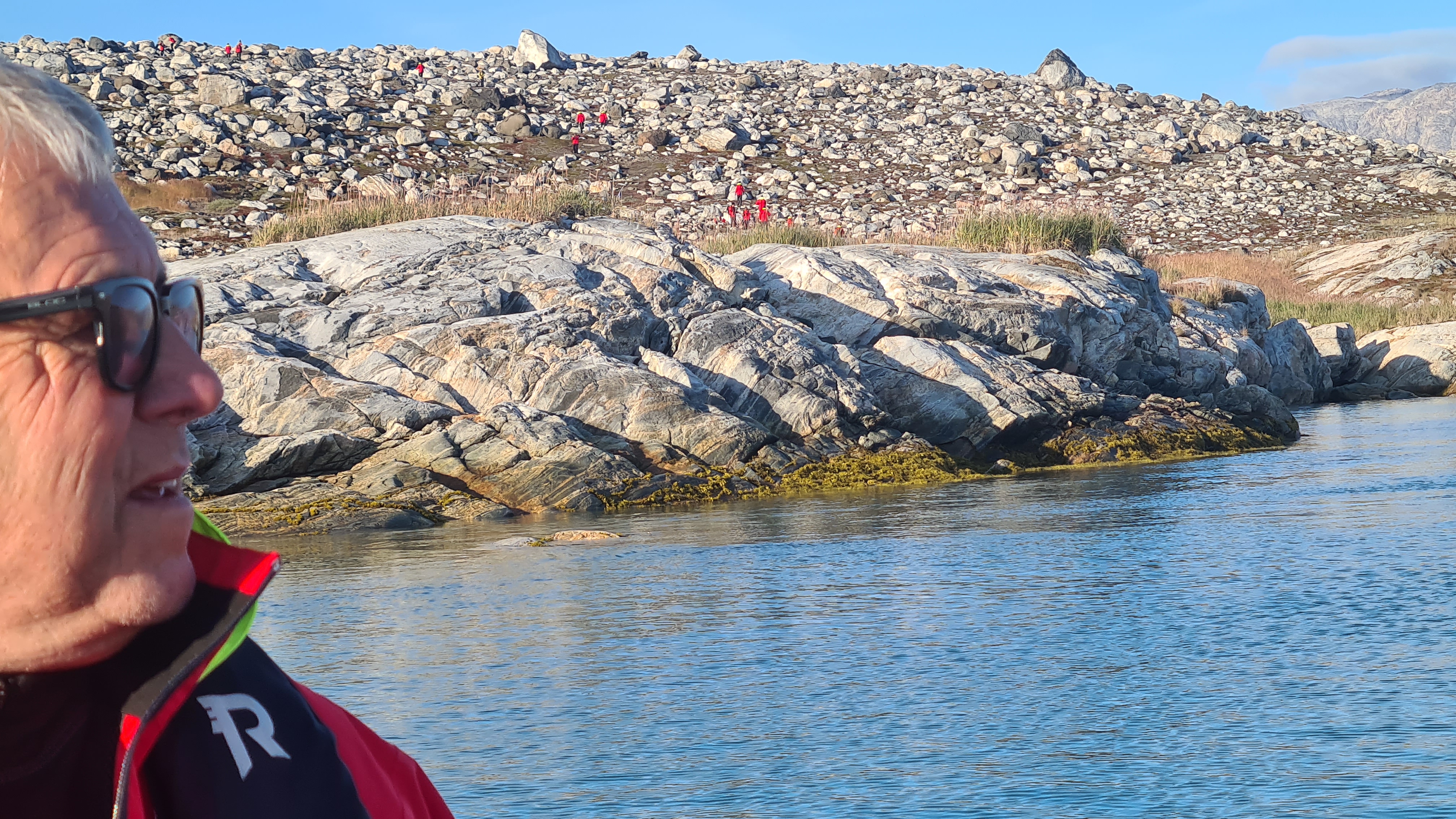
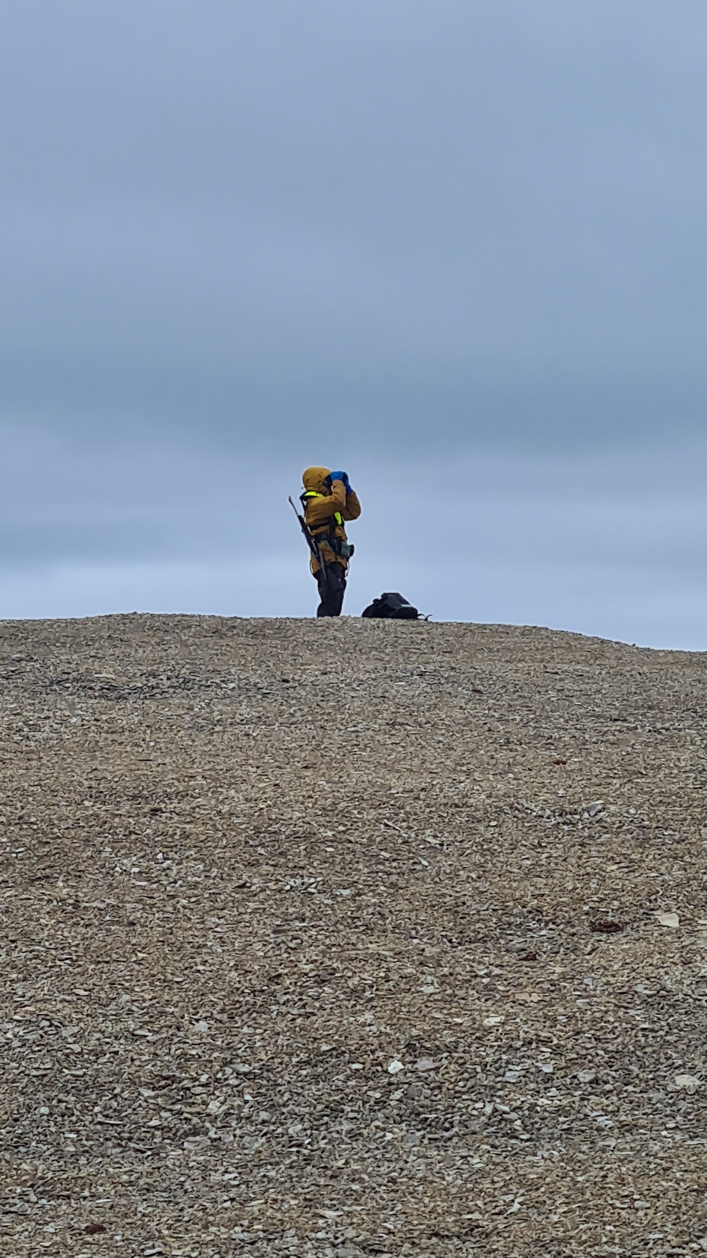
We joined a scientist to see some of the marine data gathering work that they do, before being taken ashore on a Zodiac for a beach landing. We then had a couple of hours to explore. A landing party of the Expeditions Team had marked out things to protect them, and also had several posted around with rifles and on polar bear watch!
On the beach is a single dwelling, built in 1926 and abandoned a year later, by the Hudson Bay Co. There are also many Inuit artefacts and some graves, all to remain protected under the agreements for Arctic Exploration. One of the scientists is a licensed archaeologist who takes control of this side of things.
 |
| Guides off to prepare the landing |
 |
| Stone Circle used to weigh down a tent |
HMS Enterprise & HMS Investigator
wintered at Port Leopold in 1849
during the search for Franklin and his ships Erebus & Terror
and carved this rock
 |
| (Opened) Cairn, used to leave messages |
 |
St John's Ambulance Plaque
(unexplained, and not allowed close enough to read) |
 |
Inuit artefact,
possibly a direction or
location marker |
 |
| Botanist enthuses over the tiny plants |
 |
No, I didn't know why those barrels had not been removed!
But did find out later that planes can land
occasionally and it is aviation fuel! |
 |
| Polar Bear Watch |
 |
| Whale Bone |
 |
Port Leopold
on departure |
 |
Lovely sunset behind Leopold Island
as we entered Lancaster Sound and headed west |
Next morning and before I had really got going, there was another polar bear alert, for 2 bears in fact, although I missed them. Then another alert over breakfast and, after a quick detour to the cabin to get a jacket, I managed to catch a mother and her cub strolling along the shore of Radstock Bay.
At one stage, they started a fast walk and it may have been because, not far away, they could smell another lone bear, possibly male, which was later spotted near the shore.
Radstock Bay is an important denning area for polar bears.
 |
| The lone male |
It walked in the opposite direction, so perhaps they smelt each other? There was a stiff cold breeze blowing that got to exposed flesh very quickly! Hot chocolate, served with Baileys, on deck did something to mitigate this!
 |
| Fog blowing across Radstock Bay |
 |
| Another missing glacier? |
There were may seals in the water but showed too briefly to make pictures worthwhile. The weather and light was constantly changing, freezing rain/sleet at times, the sun breaking through occasionally, so the landscape was in constant change and very pretty.
Three more polar bears were seen swimming at distance, probably a mother and two cubs.
 |
| Caswell Tower - 270m high |
 |
Hut perched atop Caswell Tower
(used by an Ian Stirling to observe polar bear
behaviour, including how far they can smell seals) |
Turning to exit Radstock Bay, the shore was mostly in shadow. Radstock Bay has remains of Thule, pre-Inuit, habitation and is an important research site in the High Arctic.
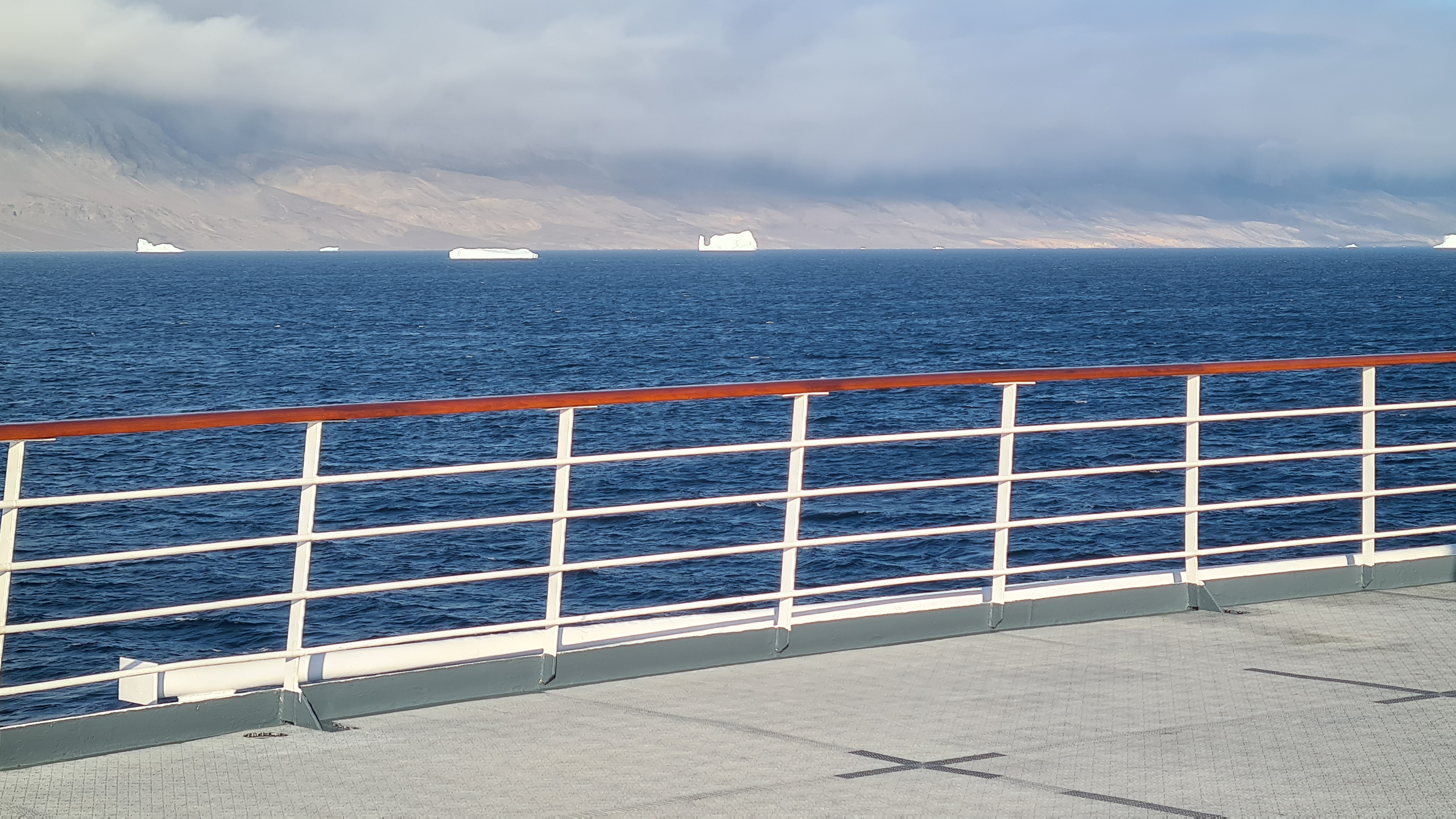
Ice? Yes, we have now seen a few icebergs!
 |
| More 'bergy bits' as they say |
So, it was then around the corner to Erebus & Terror Bay and Beechy Island, connected to the mainland by a causeway. This is famously where Franklins ships spent their first winter 1845/46 frozen in the ice. It is the westernmost end of Lancaster Sound before we then head east through the Sound to the south of Devon Island, the most commonly used entrance to the NW Passage from Baffin Bay.
 |
| Armed polar bear lookout |
I was told the rifles are about 30cal. They did not seem big enough to stop a bear, or a rabbit as one other remarked! They are licensed to Hurtigruten by the Canadian Government, and the lookouts are trained in their use. I did rather wonder 'what if?'. |
Emergency supplies
if we get stranded! |
 |
| Erebus & Terror Bay |
Next morning, we entered Dundas Harbour near the eastern entrance to Lancaster Sound. It was an RCMP and trading post and had 4 buildings, although one had been blown over by high wind. It even had a latrine and a graveyard.
 |
| Some big icebergs on the way in |
 |
The glacier is about 500m beyond
so the perspective is deceiving of the height |
 |
Learning about glacial ice
(and guide wearing a sidearm in
case of polar bears) |
There was calving at the foot of the glacier, with icebergs throughout the Bay. The glacier was estimated to be over 50m high in places and has retreated 1.7km in the last 20 years, like others due to Global Warming.
Next morning, we entered the channel from Baffin Bay towards Pond Inlet, a small settlement of 1,700 souls, with a strong and cold head wind. Either side, high and snow-capped mountains with many glaciers, although many of these have retreated and don't reach the sea anymore. A few more icebergs now lurked.
The original itinerary showed we would get to Pond Inlet via Eclipse Sound from Lancaster Sound, rather than sail out around Bylot Island and Baffin Bay. It was later revealed that restrictions now apply on this route because of disruption to the narwhal population in the Inlet, upon which the local Inuit community depend. The cause is noise from shipping from a nearby iron ore mine that affects their ability to communicate and navigate.
 |
| A jetty landing for once! |
 |
The annual, yes annual, supply of
diesel and non-perishables
(happened to be there at the same time) |
 |
Whalebone roof supports
for a 'sod house' |
 |
| Sod house base, from early 1900s! |
 |
| Pond Inlet |
 |
| Local guide |
 |
| Typical scene around the settlement |
 |
| Climate Change Monitoring Station |
 |
| Parks Canada Admin & Visitor Centre |
 |
Fram in front of a large iceberg
at Pond Inlet |
 |
| Anglican church |
 |
Heath Centre
Doctor & Dentist only visit once per month! |
 |
| Child's skin clothing |
 |
| Hamlet Office with Fire Station next door |
 |
Fresh goods have to be flown in
and prices have risen steeply
(storage in front and beside) |
 |
| Cultural Centre |
We were treated to a exhibition of Inuit games of high kicking, several 1:1 contests including cheek pulling, then drum dancing and throat singing, which was all impressive and entertaining.
 |
High Kick Target
Kicker has to first jump from two feet
before kicking with one |
 |
| 1:1 pushing contest |
It's just the two girls singing
holding each other's elbows
until one laughs or they can't keep it up any longer!
Then, we set sail for 2 days to cross Baffin Bay, leaving Canada temporarily, for Greenland. A lecture on board from a Scots Oceanographer gave us insight into the global currents, tides and changes to them in this part of the world because of climate change. It is more pronounced here with what is called 'polar amplification'.
Then we crossed >3,000m deep Baffin Bay, very different to the shallow waters of the NW Passage route in the narrow channels of the Arctic Archipelago. Icebergs, some very sizeable, were seen from time to time, carried south by the currents of the Bay.
The sea stayed calm and for a while there were no Icebergs to be seen, but we were rewarded with a superb sunset astern.
Next morning, icebergs were back as we got closer to the shores of Greenland, the World's biggest island.
 |
| Taller than Fram |
 |
| And given a wide berth |
Some are as big as small islands and are drifting north along the coast with the currents from Disko Bay, which we entered while en route to Ilulissat, between Disko Island and the mainland of Greenland. All eyes on the Bridge were on the radar and binoculars were to hand!
The icebergs just kept coming as the wind stiffened and numbed the fingers. Steep mountains with snow caps lined either side of the channel as we sailed on into the afternoon, to Ilulissat tomorrow morning.
At a lecture on rising sea and land temperatures, our Oceanographer gave us further insight into the effects of the loss of sea ice and permafrost on the landscape and well-being of animals, humans and sea life, which did not make good listening. He has been a scientist on this voyage for each of the last few years, and this is the first time he has experienced no ice in the NW Passage. The increase in average sea temperature appears to be runaway and does not bode well. This is largely because of the lack of ice reflecting the heat that now reaches and warms the sea. It's an accelerating process and there is now less multiple-year ice (doesn't melt in between).
An early morning anchoring in Ilulissat, our first Greenland stop, once again blessed us with sunshine and the temperature had 'soared' to 2degC! How beneficial that sunshine would be for our boat trip to the foot of the glacier that produces 10% of Greenland's icebergs. This is clearly a major calving place for many of the big bergs we have seen in the last days on our approach.
Once anchored and breakfasted, we went ashore to have a brief look around the harbour area before boarding a fishing boat to see the glacier from the water. It's a different place to our last stops - population of some 5,000, almost as many sled dogs, more developed, bigger & with smartly maintained colourful houses and apartments blocks, tarmac roads and a couple of large fish processing plants dockside. It's the third largest city in Greenland.
 |
| B&B and dog |
 |
| Royal Greenland fish processing plant |
A short journey took us to the outlet of the Sermeq Kujalleq glacier, where massive icebergs had calved and were showing signs of breaking up further before floating off elsewhere. The picture opportunities were almost unlimited!
 |
| Guestimate 50m high |
 |
| Some ice has just dropped |
 |
| Fram lurking behind! |
Many speedboats were going to and from the harbour, to where we do not know, but a few appeared equipped for fishing. Late afternoon, we sailed off through the icebergs and into a nice sunset in Disko Bay.
 |
| Another monster! |
Overnight, we sailed further down the coast to Sisimiut, a place of about 6,000 builts on hills and hummocks around various inlets and just 40km north of the Arctic Circle, our last stop inside it since the journey began. It is very colourful with its painted timber buildings, many perched on peaks. We had wisely booked a bus tour so saw a lot more of it than had we just walked.
The fish plant was smaller than yesterday and the town overall seemed less industrial. The many small boats used for fishing and pleasure are removed from the water for the winter freeze. Then, the hunting season begins.
 |
Fisherman with halibut
250 years memorial |
The vast majority of dogs, as many as there are people, are working sled dogs who live outside. As the town grew in population, so the area where the dogs live was moved further outside. There seemed to be kennels and dogs in all directions in this valley. Further south, the majority changes to domestic pets.
 |
| Sleds and dogs at the ready |
 |
Mother with pups
(feeds standing up) |
We stopped at various points above the town, able to see the many coloured and perched dwellings around it. There was a greater diversity of vehicle types, but winter needs still must!
 |
Houses with a view
but no garden! |
 |
| Current church |
 |
| Mud hut |
 |
| Original church |
 |
Rock carving of a humpback
whale by the roadside |
A short while after departing Sisimiut, we crossed the Arctic Circle and a ceremony to punctuate it was held, and some were brave/mad enough to volunteer to be a part of it!
 |
| The Scene is set! |
 |
| Sometimes a bucket is used! |
The idea is that the Captain ladles ice and water down the back of the neck of those co-opted by a Neptune-like character (Ben, the Historian), and are then rewarded with two glasses of Aquavit! We passed on the offer.
Next morning, our long run of exceptional weather ran out as we docked in a drizzling and cold Nuuk, the capital of Greenland. Several Expedition Team members said they had not known sunshine in Sisimiut as we had yesterday, and associated Greenland with rain, so we counted our luck.
Nuuk has a population of 20,000, which is over a third of Greenland's total of 56,000, and it occurred to me that we had now visited 3 places that accounted for two thirds of that total! It is quite astonishing on the World's largest island and just shows how little is inhabited.
It is considerably more urban than the other two, but still has the same multitude of coloured timber buildings, many of which are build on very uneven rocky ground. The colours traditionally used to follow your employment sector - Government, commerce, teaching etc - but it is less stringently followed nowadays. There are more multistorey and apartment block structures here, apparently because of the expense of a foundation on such uneven rocky ground, so they build up. We enjoyed a bus tour with stops for photos, but it wasn't really conducive to extensive walkabout because of the rain and the spread of the place and its suburbs.
 |
Big trawler
(fishing still prevalent here) |
 |
Extra gangway
for low tide later as the ship's
own fell below the quayside |
 |
Most people have a car and a boat, although
the boats have to come out when it freezes
to avoid damage |
 |
| The brewery |
 |
Graveyard entrance and
icebergs in the distance
from fjords nearby |
 |
| University |
 |
| 'Mother of the Sea' |
Early next morning, we sailed into Kvanefjord some 30km and welcomed the return of exceptional sunshine! We landed by Zodiac and then clambered up over rocks and around boulders to feast on outstanding views of the fjord, the ship and a (retreating) glacier. Even the kayakers got out today for the first time on the calm water.
 |
| Sunrise in the fjord |
 |
| Polar Bear watch continues |
 |
| Beautiful, peaceful and serene |
But, as we turned to cross the Labrador Sea, the chilly wind began to dominate the moment!
Then, we settled down to the rest of today and tomorrow to sail to Labrador and Red Bay as we return to Canada.
Along the way, the sky greyed over, the ship began to pitch & roll and it rained, so on deck became less of a draw. We also heard reports of Hurricane Lee forecast to hit the coast of Maine that the Captain is keeping track of.
In the evening, a band made up of some Filipina crew performed in he Lounge, including our waitress, Nechel, on guitar & vocal and waiter, William, on drums.
Overnight, the rock & roll of the ship continued and the following morning was heralded in with fog and frequent sounding of the fog horn, access to the port deck being closed off portside with a very stiff wind blowing as we closed in on the coast of Labrador.
 |
| Starboard! |
I sneaked around the bow to Port to try and have a peek to windward and nearly got blown off my feet, so retreated quickly! The rest of the journey into Red Bay remained in fog and mist, but the sea and wind tempered a little as we got closer.
Red Bay is an abandoned Basque whaling station from the 1500's and our visitors nearly doubled its population while onshore! Arriving a little later than schedule and then having to wait for Border Control to come on board and clear us to land, meant that our stop ashore was shorter than planned but enough. Once again, the Captain had unloaded the sunshine and cleared the fog before deploying the Zodiacs, so we were blessed once more!
The Province of Newfoundland & Labrador is young, 1949, but each retains an unofficial identity and flag, and a half-hour time difference to those others beside them! Our Canadian guide and Botanist drew attention to the pink stripe in the Newfoundland flag as another expression of their separatism. In addition, the Newfoundland dog comes from Labrador, whereas the Labrador comes from Newfoundland?!
Ashore in Corner Brook, we went on the trail of Captain James Cook. Over 300 years ago, he honed his navigation and surveying skills in Newfoundland over a 5 year period, before heading off to discover the Pacific. Many of his soundings have been recently proved accurate with the latest technology.
 |
| Monster cruise liner |
 |
Lark Harbour
a very windy place indeed |
Named after one of Cook's ships, this bay is seriously windy, but we were treated to a warm reception at the local church.
 |
Our host (pastor?) was originally
from Drakes Broughton, nr Pershore! |
 |
| Eats, drinks and local crafts |
 |
| Coastguard Zodiac & Launch |
They say that when the Zodiac is taken out of the water, it's going to be more windy, if they take it away, it's going to be worse and, if the launch goes, it's going to be terrible! |
Aptly named library!
And there's a mountain nearby
with the same name |
 |
Fishing village
(but I couldn't work out the role
of the small vessels astern) |
 |
| Paper mill |
 |
| Captain Cook |
 |
Fram on the choppy water below
Captain Cook look-out |
Back on board, we were treated to a local singing duo and could have been in an Irish pub. Many settled here during the Great Famine and their accent still endures in the local dialects.
How it was to change with Hurricane Lee turning northeast after its landfall in New England, heading our way. In the evening we began to pitch and roll and it continued through the following day. The sea strengthened to an 8 metre swell and the wind whipped up the white tops. We lurched around the ship as though we had had far too much to drink! This was the view astern through the restaurant window over breakfast, the horizon disappearing above the top to below the bottom of the window!
The heavy sea meant our speed had to reduce from 14kn to 4kn, which means a 5h delay to our arrival in Boston tomorrow. But the storm passed us and by mid evening it was calmer again.
I made a very interesting visit to the Bridge where the Captain explained some of the high tech equipment at his disposal. We were on autopilot at the time and it all seemed very relaxed.
 |
| Main Controls |
 |
Captain explains the Depth Chart
(ships share data so there is
a huge amount of data today) |
 |
| Engine Control |
 |
Steerable propellers that
can also be used as stern thrusters |
He also explained that the speed reduction was necessary to avoid damage to the ship, and the propellers coming out of the water as it pitched.
The last stretch into Boston was calm and good speed was made again. After leaving Fram, rather sadly for the end of our voyage, we then enjoyed some time in Boston and saw a few sights before heading for the airport and the final leg home.
 |
Paul Revere house
An American Patriot and Founding Father
who had a major role at the outset of
the Revolution that began
The War of Independence |
 |
| Paul Revere statue |
 |
Old North Church
where the lanterns were lit that
signalled where the British Troops were heading
and is regarded the earliest event in the
War of Independence |
 |
Iraq & Afghanistan
Soldiers Lost
marked with dog tags |
 |
Pews in Old North Church
(had to be bought) |
 |
| A brief visit to Harvard |
 |
| Library |
 |
| John Harvard statue |
 |
| Boston Public Library |
 |
One of many lovely
old stone churches |
 |
| George Washington |
Boston is a very appealing city with a mix of older and stylish buildings alongside limited high rise and with wide streets. The traffic didn't move quickly, however!
So, wow! What an outstanding trip and experience to a part of our Planet so steeped in a history of tragedy and loss of life to discover the Northwest Passage, which remains largely undisturbed. Hurtigruten were at pains to leave no trace of us and keep it that way. It was most certainly an expedition and not a cruise. We can only hope that the retreating ice and climate change do not bring a risk of uncontrolled exploitation of this long sought after route from Europe to Asia and the damage that could bring to the environment and to the Inuit peoples who still, but sparsely, inhabit the harsh and unforgiving land.


.jpg)